Property Record
2920 Scottsville Rd, Bowling Green, KY 42104
NEARBY LISTINGS FOR SALE OR LEASE
Property Detail
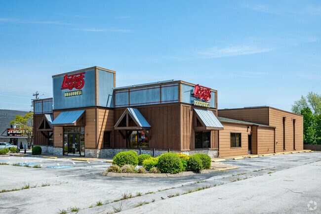
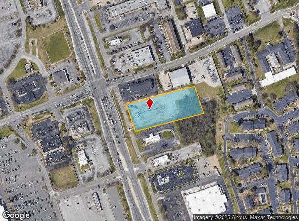
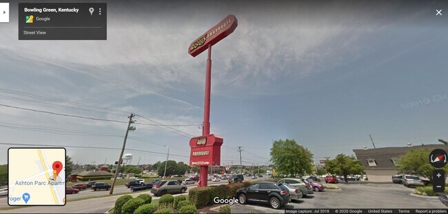
2920 Scottsville Rd
053A-01-007
Interchange Properties Subdivision
Restaurantbuilding
Warren
X
Kentucky
21227C0308E
1.87 AC
2025
Bowling Green Area
2025
Other Market Areas
010701
Bowling Green, KY
8,403 SF
DEMOGRAPHICS near 2920 Scottsville Rd
1 Mile
3 Mile
5 Mile
2024 Total Population
11,279
44,808
97,709
2029 Population
12,550
49,490
107,608
Pop Growth 2024-2029
+ 11.27%
+ 10.45%
+ 10.13%
Average Age
36
38
36
2024 Total Households
4,921
18,889
37,776
HH Growth 2024-2029
+ 11.73%
+ 10.88%
+ 10.81%
Median Household Inc
$44,079
$61,910
$54,928
Avg Household Size
2.20
2.30
2.40
2024 Avg HH Vehicles
2.00
2.00
2.00
Median Home Value
$244,453
$259,879
$245,310
Median Year Built
1999
1993
1992
Nearby Places
Map Layers
Map Styles
 Street
 Aerial
- Restaurants
- Banks
- Shops
- Fitness
- Groceries
SALE & LEASE HISTORY
LISTING DATE
SALE/LEASE

Nov 03, 2021
For Sale
Mar 21, 2019
For Sale
Jun 01, 2020
For Lease
Feb 28, 2017
For Sale
Feb 28, 2017
For Sale
Nearby Properties
Address
Land Use
TOTAL SIZE
Lot Size
Zoning
Address
Land Use
TOTAL SIZE
Lot Size
Zoning
Address
Land Use
TOTAL SIZE
Lot Size
Zoning
26,586 SF
17.19 AC
Address
Land Use
TOTAL SIZE
Lot Size
Zoning
7,399 SF
57.89 AC
Address
Land Use
TOTAL SIZE
Lot Size
Zoning
15,440 SF
16.52 AC
Address
Land Use
TOTAL SIZE
Lot Size
Zoning
12.29 AC
Address
Land Use
TOTAL SIZE
Lot Size
Zoning
261,579 SF
17.71 AC
Address
Land Use
TOTAL SIZE
Lot Size
Zoning
Address
Land Use
TOTAL SIZE
Lot Size
Zoning
173,947 SF
11.53 AC
Address
Land Use
TOTAL SIZE
Lot Size
Zoning
59,812 SF
21.30 AC
Address
Land Use
TOTAL SIZE
Lot Size
Zoning
175,830 SF
8 AC
Address
Land Use
TOTAL SIZE
Lot Size
Zoning
39,504 SF
19.74 AC
Address
Land Use
TOTAL SIZE
Lot Size
Zoning
86.84 AC
Address
Land Use
TOTAL SIZE
Lot Size
Zoning
105,987 SF
7.98 AC
Address
Land Use
TOTAL SIZE
Lot Size
Zoning
261,196 SF
13.01 AC
Address
Land Use
TOTAL SIZE
Lot Size
Zoning
100,193 SF
9.82 AC
Address
Land Use
TOTAL SIZE
Lot Size
Zoning
40.04 AC
Address
Land Use
TOTAL SIZE
Lot Size
Zoning
Address
Land Use
TOTAL SIZE
Lot Size
Zoning
142,199 SF
12.95 AC
Address
Land Use
TOTAL SIZE
Lot Size
Zoning
192,994 SF
22.55 AC
Address
Land Use
TOTAL SIZE
Lot Size
Zoning
6.55 AC
Address
Land Use
TOTAL SIZE
Lot Size
Zoning
54.74 AC
Address
Land Use
TOTAL SIZE
Lot Size
Zoning
96,696 SF
9.69 AC
Address
Land Use
TOTAL SIZE
Lot Size
Zoning
208,264 SF
26.05 AC
Address
Land Use
TOTAL SIZE
Lot Size
Zoning
43,144 SF
18.61 AC
Address
Land Use
TOTAL SIZE
Lot Size
Zoning
Address
Land Use
TOTAL SIZE
Lot Size
Zoning
Address
Land Use
TOTAL SIZE
Lot Size
Zoning
17,010 SF
9.64 AC
Address
Land Use
TOTAL SIZE
Lot Size
Zoning
15,392 SF
8.50 AC
Address
Land Use
TOTAL SIZE
Lot Size
Zoning
77,160 SF
3.05 AC
Address
Land Use
TOTAL SIZE
Lot Size
Zoning
62,904 SF
2.04 AC
The World's #1 Commercial Real Estate Marketplace
Connect with us
© 2026 CoStar Group
The information above has been obtained from sources believed reliable. While we do not doubt its accuracy we have not verified it and make no guarantee, warranty or representation about it. It is your responsibility to independently confirm its accuracy and completeness. Any projections, opinions, assumptions, or estimates used are for example only and do not represent the current or future performance of the property. The value of this transaction to you depends on tax and other factors which should be evaluated by your tax, financial, and legal advisors. You and your advisors should conduct a careful, independent investigation of the property to determine to your satisfaction the suitability of the property for your needs.